7-day forecast
Open-Meteo · trail point · local dates · last updated Nov 11, 2026, 3:10 PM PTThu 12
Rain showers
12°C / 7°C
98% · 19.2 mm
Wind 26 km/h
PoorFri 13
Light rain
7°C / -1°C
100% · 3.7 mm
Wind 24 km/h
PoorSat 14
Overcast
12°C / -3°C
8% · 0.0 mm
Wind 31 km/h
GoodSun 15
Light rain
11°C / 8°C
40% · 0.6 mm
Wind 32 km/h
FairMon 16
Light rain
9°C / 5°C
50% · 6.5 mm
Wind 19 km/h
FairTue 17
Rain showers
13°C / 6°C
69% · 10.8 mm
Wind 35 km/h
FairWed 18
Overcast
11°C / 7°C
69% · 0.8 mm
Wind 23 km/h
FairRoute
No route line in this build. No OpenStreetMap route relation is linked for this trail.
About this trail
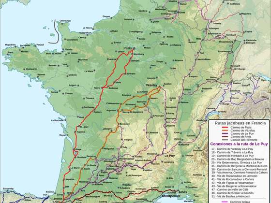
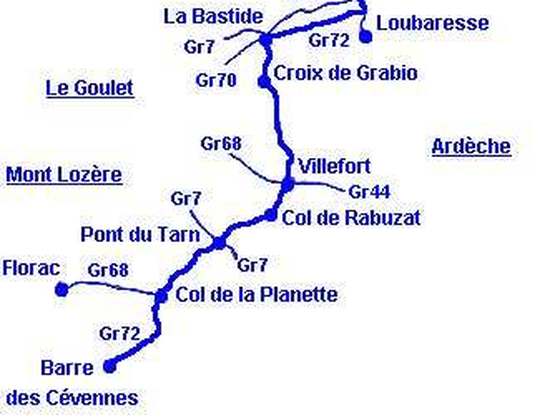
The GR 70, also known as the Chemin de Stevenson or the Robert Louis Stevenson Trail, is a Grande Randonnée that runs for approximately 225 kilometres (140 mi) through the French departments of Haute-Loire, Lozère and Gard in a generally north–south direction from Le Monastier-sur-Gazeille to Saint-Jean-du-Gard. It follows approximately the route taken by Robert Louis Stevenson in 1878, a journey described in his book Travels with a Donkey in the Cévennes.
From the Wikipedia article “GR 70”, CC BY-SA 4.0.
Trail facts
- Length
- 272 km · 169 mi (Wikidata)
- Countries
- France
- Continent
- Europe
- Trail point
- 44.93970, 3.99610 (Wikidata coordinate)
- Wikidata
- Q2962322
- Official info
- chemin-stevenson.org
Hiked it?
Log this hikeAdd a GPX file for the Verified Track badge. The first and last 500 m are trimmed off before anything is measured, and the file itself is not kept.