7-day forecast
Open-Meteo · trail point · local dates · last updated Nov 11, 2026, 3:10 PM PTThu 12
Light rain
4°C / 1°C
28% · 0.0 mm
Wind 14 km/h
FairFri 13
Overcast
6°C / -0°C
45% · 0.0 mm
Wind 17 km/h
FairSat 14
Overcast
6°C / 1°C
0% · 0.0 mm
Wind 11 km/h
GoodSun 15
Overcast
10°C / 2°C
37% · 0.8 mm
Wind 19 km/h
FairMon 16
Light rain
9°C / 6°C
58% · 1.6 mm
Wind 21 km/h
FairTue 17
Rain showers
13°C / 6°C
76% · 9.3 mm
Wind 30 km/h
PoorWed 18
Overcast
13°C / 9°C
76% · 0.6 mm
Wind 23 km/h
PoorRoute
No route line in this build. This is a very long route, so only its start point is used.
About this trail
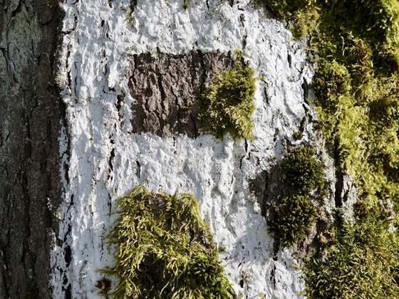
The Hermannsweg is a 156 kilometres (97 mi) long hiking trail which follows the ridge of the Teutoburg Forest, running from Rheine to Velmerstot in Germany. It is marked by signposts showing a white H on a black background. The Hermannsweg is named for Arminius, a Cherusci chief who defeated the Romans in the Battle of the Teutoburg Forest in 9 AD. Together with the 70 kilometres (43 mi) long Eggeweg, this long-distance hiking trail forms the Hermannshöhen. It is maintained by the Teutoburger-Wald-Verein e.V., located in Bielefeld.
From the Wikipedia article “Hermannsweg”, CC BY-SA 4.0.
Trail facts
- Length
- 226 km · 140 mi (OpenStreetMap distance tag)
- Countries
- Germany
- Continent
- Europe
- Trail point
- 51.91110, 8.84627 (Wikidata coordinate)
- OSM network
- Regional walking network
- Operator (OSM)
- TWV Teutoburger Wald Verband;EGV Eggegebirgsverein
- Wikidata
- Q524597
- OpenStreetMap
- relation 2092679
- Official info
- hermannshoehen.teutoburgerwald.de
Hiked it?
Log this hikeAdd a GPX file for the Verified Track badge. The first and last 500 m are trimmed off before anything is measured, and the file itself is not kept.
Photo: “Externsteine pano.jpg” by Daniel Schwen, CC BY-SA 2.5, via Wikimedia Commons (resized).