7-day forecast
Open-Meteo · trail point · local dates · last updated Nov 11, 2026, 3:10 PM PTWed 11
Heavy drizzle
8°C / 2°C
100% · 7.0 mm
Wind 11 km/h
PoorThu 12
Overcast
5°C / -1°C
0% · 0.0 mm
Wind 17 km/h
GoodFri 13
Overcast
7°C / -2°C
0% · 0.0 mm
Wind 8 km/h
GoodSat 14
Overcast
6°C / 0°C
4% · 0.0 mm
Wind 18 km/h
GoodSun 15
Light rain
8°C / 4°C
75% · 7.8 mm
Wind 17 km/h
PoorMon 16
Overcast
7°C / -1°C
33% · 0.0 mm
Wind 28 km/h
FairTue 17
Drizzle
3°C / -1°C
61% · 8.9 mm
Wind 17 km/h
FairRoute
Route line © OpenStreetMap contributors (ODbL), simplified. Dot: trail point.
About this trail
Offa's Dyke Path is a long-distance footpath loosely following the Wales–England border. Officially opened on 10 July 1971, by Lord Hunt, it is one of Britain's National Trails and draws walkers from throughout the world. About 60 miles (97 km) of the 177-mile (285 km) route either follows, or keeps close company with, the remnants of Offa's Dyke, an earthwork traditionally thought to have been constructed in the late 8th century on the orders of King Offa of Mercia.
From the Wikipedia article “Offa's Dyke Path”, CC BY-SA 4.0.
Trail facts
- Length
- 285 km · 177 mi (Wikidata)
- Countries
- United Kingdom
- Continent
- Europe
- Trail point
- 52.34580, -3.05170 (Wikidata coordinate)
- OSM network
- National walking network
- Operator (OSM)
- National Trails
- Wikidata
- Q745914
- OpenStreetMap
- relation 9649
Hiked it?
Log this hikeAdd a GPX file for the Verified Track badge. The first and last 500 m are trimmed off before anything is measured, and the file itself is not kept.
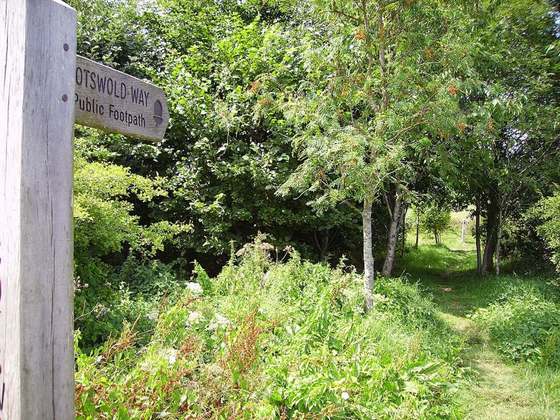
Photo: “Offa's Dyke Path signpost. - geograph.org.uk - 501938.jpg” by David Quinn, CC BY-SA 2.0, via Wikimedia Commons (resized).