7-day forecast
Open-Meteo · trail point · local dates · last updated Nov 11, 2026, 3:10 PM PTThu 12
Light drizzle
9°C / 0°C
27% · 0.4 mm
Wind 29 km/h
FairFri 13
Light rain
9°C / 6°C
25% · 3.0 mm
Wind 44 km/h
FairSat 14
Drizzle
8°C / 2°C
0% · 0.8 mm
Wind 18 km/h
FairSun 15
Light drizzle
11°C / 1°C
63% · 2.6 mm
Wind 30 km/h
FairMon 16
Light drizzle
11°C / 8°C
71% · 1.2 mm
Wind 36 km/h
PoorTue 17
Drizzle
9°C / 5°C
44% · 4.5 mm
Wind 32 km/h
FairWed 18
Drizzle
10°C / 5°C
49% · 7.6 mm
Wind 33 km/h
FairRoute
No route line in this build. This is a very long route, so only its start point is used.
About this trail
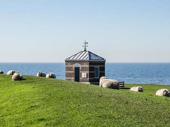
The Pieterpad is a long distance walking route in the Netherlands. The trail runs 498 kilometres (309 mi) from Pieterburen, in the northern part of Groningen, south through the eastern part of the Netherlands to end just south of Maastricht, on the top of Mount Saint Peter, at a height of 109 metres (358 ft). The Pieterpad is one of the official Long Distance Paths in the Netherlands and by far the most popular of its long distance walking routes. It is possible to walk the route in either direction, and throughout the year. It is well signposted, and is well served by public transport and accommodation throughout its length. The official guide book is in two volumes, Pieterburen-Vorden and Vorden-Maastricht. A dedicated website also gives updated accommodation details. Although the walking is always easy and never remote, it is a varied and often beautiful walk, passing through woods, polders, heathland, and numerous small Dutch villages.
From the Wikipedia article “Pieterpad”, CC BY-SA 4.0.
Trail facts
- Length
- 492 km · 306 mi (Wikidata)
- Countries
- Netherlands
- Continent
- Europe
- Trail point
- 53.40004, 6.45312 (OpenStreetMap route (first mapped point))
- OSM network
- National walking network
- Operator (OSM)
- Wandelnet / Nivon
- Wikidata
- Q19727555
- OpenStreetMap
- relation 7973533
- Official info
- nivon.nl/pieterpad-1-en-2
Hiked it?
Log this hikeAdd a GPX file for the Verified Track badge. The first and last 500 m are trimmed off before anything is measured, and the file itself is not kept.