7-day forecast
Open-Meteo · trail point · local dates · last updated Nov 11, 2026, 3:10 PM PTThu 12
Snow
-7°C / -8°C
100% · 9.2 mm
Wind 38 km/h
PoorFri 13
Overcast
-8°C / -10°C
0% · 0.0 mm
Wind 58 km/h
PoorSat 14
Heavy snow
-3°C / -10°C
100% · 5.2 mm
Wind 30 km/h
PoorSun 15
Snow
-3°C / -11°C
88% · 7.2 mm
Wind 18 km/h
PoorMon 16
Snow showers
-7°C / -13°C
63% · 4.5 mm
Wind 9 km/h
FairTue 17
Snow showers
-6°C / -8°C
55% · 11.0 mm
Wind 8 km/h
FairWed 18
Light snow
-6°C / -8°C
27% · 1.0 mm
Wind 2 km/h
FairRoute
Route line © OpenStreetMap contributors (ODbL), simplified. Dot: trail point.
About this trail
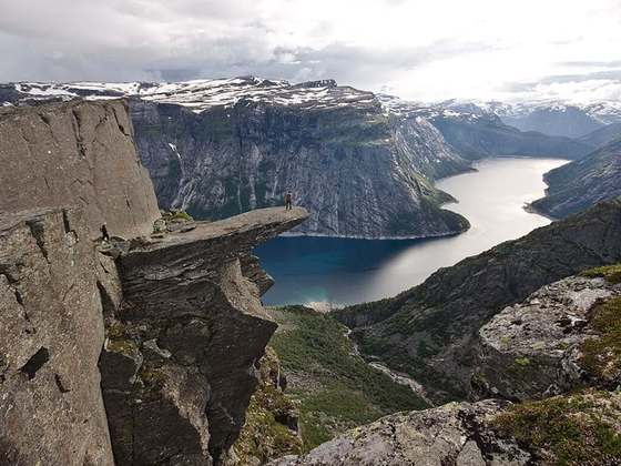
Besseggen is a mountain ridge in Vågå Municipality in Innlandet county, Norway. The 1,634-metre (5,361 ft) tall mountain ridge is located in the Jotunheimen mountains within Jotunheimen National Park. The mountain sits about 46 kilometres (29 mi) southwest of the village of Vågåmo and about 30 kilometres (19 mi) northwest of the village of Beitostølen. The mountain ridge is surrounded by several other notable mountains including Veslfjellet to the east and Besshøe to the northwest. The ridge runs between the lakes Gjende and Bessvatnet.
From the Wikipedia article “Besseggen”, CC BY-SA 4.0.
Trail facts
- Countries
- Norway
- Continent
- Europe
- Trail point
- 61.50293, 8.72683 (OpenStreetMap path midpoint (Nominatim))
- Operator (OSM)
- Den Norske Turistforening
- Wikidata
- Q830100
- OpenStreetMap
- way 26119384
Hiked it?
Log this hikeAdd a GPX file for the Verified Track badge. The first and last 500 m are trimmed off before anything is measured, and the file itself is not kept.
Photo: “Gjende from Besseggen.jpg” by "color line", CC BY 2.0, via Wikimedia Commons (resized).