7-day forecast
Open-Meteo · trail point · local dates · last updated Nov 11, 2026, 3:10 PM PTThu 12
Rain
16°C / 11°C
95% · 7.9 mm
Wind 9 km/h
PoorFri 13
Light drizzle
16°C / 10°C
30% · 0.2 mm
Wind 7 km/h
FairSat 14
Drizzle
17°C / 11°C
48% · 1.1 mm
Wind 7 km/h
FairSun 15
Light drizzle
17°C / 11°C
58% · 0.2 mm
Wind 17 km/h
FairMon 16
Overcast
14°C / 7°C
48% · 0.5 mm
Wind 13 km/h
FairTue 17
Light drizzle
21°C / 7°C
50% · 1.0 mm
Wind 11 km/h
FairWed 18
Light drizzle
19°C / 10°C
34% · 3.2 mm
Wind 15 km/h
FairRoute
Route line © OpenStreetMap contributors (ODbL), simplified. Dot: trail point.
About this trail
The Cares Trail or Ruta del Cares is one of the most popular trekking paths within the Picos de Europa. The route is situated between the province of León and Asturias, in Spain. It runs from the Asturian village of Puente Poncebos to Posada de Valdeón through Caín in Leon along the Cares Canyon. In the old times, the route was the only way to reach both towns during the snow seasons in the winter.
From the Wikipedia article “Cares Trail”, CC BY-SA 4.0.
Trail facts
- Countries
- Spain
- Continent
- Europe
- Trail point
- 43.23940, -4.89030 (Wikidata coordinate)
- Wikidata
- Q6114450
- OpenStreetMap
- relation 2687934
- Official info
- miteco.gob.es/es/red-parques-nacionales/nuestros
Hiked it?
Log this hikeAdd a GPX file for the Verified Track badge. The first and last 500 m are trimmed off before anything is measured, and the file itself is not kept.
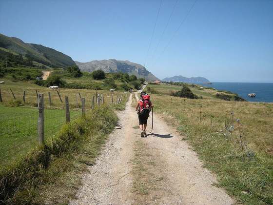
Photo: “Desfiladero del Cares 02.JPG” by Cruccone, CC BY 3.0, via Wikimedia Commons (resized).