7-day forecast
Open-Meteo · trail point · local dates · last updated Nov 11, 2026, 3:10 PM PTWed 11
Drizzle
11°C / 7°C
72% · 1.3 mm
Wind 14 km/h
PoorThu 12
Overcast
8°C / 3°C
0% · 0.0 mm
Wind 16 km/h
GoodFri 13
Overcast
7°C / 2°C
0% · 0.0 mm
Wind 11 km/h
GoodSat 14
Light drizzle
10°C / 6°C
60% · 0.5 mm
Wind 27 km/h
FairSun 15
Drizzle
10°C / 7°C
76% · 5.5 mm
Wind 27 km/h
PoorMon 16
Overcast
7°C / 5°C
29% · 0.0 mm
Wind 24 km/h
GoodTue 17
Light drizzle
7°C / 2°C
61% · 1.5 mm
Wind 30 km/h
FairRoute
Route line © OpenStreetMap contributors (ODbL), simplified. Dot: trail point.
About this trail
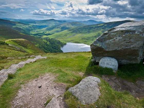
The Dublin Mountains Way is a waymarked long-distance trail in the Dublin Mountains, Counties South Dublin and Dún Laoghaire–Rathdown, Ireland. The route is approximately 42 kilometres long and runs from Shankill in the east to Tallaght in the west. It has been developed by the Dublin Mountains Partnership, an umbrella group of relevant state agencies and recreational users working to improve recreational facilities in the Dublin Mountains.
From the Wikipedia article “Dublin Mountains Way”, CC BY-SA 4.0.
Trail facts
- Length
- 52 km · 32 mi (Wikidata)
- Countries
- Ireland
- Continent
- Europe
- Trail point
- 53.28124, -6.37380 (OpenStreetMap route (first mapped point))
- OSM network
- National walking network
- Wikidata
- Q3040526
- OpenStreetMap
- relation 286707
- Official info
- dublinmountains.ie/dublin_mountains_way/dublin_m
Hiked it?
Log this hikeAdd a GPX file for the Verified Track badge. The first and last 500 m are trimmed off before anything is measured, and the file itself is not kept.
Photo: “Dublin Mountains Way Waymarker.jpg” by Joe King, CC BY-SA 3.0, via Wikimedia Commons (resized).