7-day forecast
Open-Meteo · trail point · local dates · last updated Nov 11, 2026, 3:10 PM PTThu 12
Rain showers
13°C / 5°C
38% · 0.4 mm
Wind 16 km/h
FairFri 13
Light rain
7°C / 2°C
80% · 0.6 mm
Wind 27 km/h
PoorSat 14
Overcast
7°C / -1°C
0% · 0.0 mm
Wind 16 km/h
GoodSun 15
Overcast
7°C / -1°C
2% · 0.0 mm
Wind 24 km/h
GoodMon 16
Light rain
8°C / 5°C
12% · 3.0 mm
Wind 22 km/h
FairTue 17
Overcast
11°C / 3°C
18% · 0.0 mm
Wind 35 km/h
GoodWed 18
Rain
11°C / 8°C
31% · 24.9 mm
Wind 29 km/h
FairRoute
No route line in this build. No OpenStreetMap route relation is linked for this trail.
About this trail
Mieczysław Orłowicz Main Sudetes Trail is a public hiking trail in Poland running along the Sudetes. The total length of this route is 443 km and the approximate time to cover it is about 120 hours. The trail was constructed in 1947 and throughout its history has been several times modified. It is blazed red.
From the Wikipedia article “Main Sudetes Trail”, CC BY-SA 4.0.
Trail facts
- Length
- 440 km · 273 mi (Wikidata)
- Countries
- Poland
- Continent
- Europe
- Trail point
- 50.32890, 17.57770 (Wikidata coordinate)
- Wikidata
- Q5627668
Hiked it?
Log this hikeAdd a GPX file for the Verified Track badge. The first and last 500 m are trimmed off before anything is measured, and the file itself is not kept.
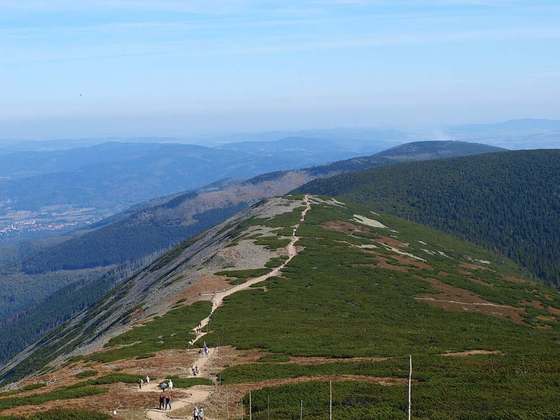
Photo: “Główny Szlak Sudecki - panoramio (19).jpg” by Jarosław Szczepaniak, CC BY-SA 3.0, via Wikimedia Commons (resized).