7-day forecast
Open-Meteo · trail point · local dates · last updated Nov 11, 2026, 3:10 PM PTThu 12
Rain showers
4°C / -3°C
95% · 11.5 mm
Wind 32 km/h
PoorFri 13
Snow showers
-3°C / -6°C
95% · 2.8 mm
Wind 34 km/h
PoorSat 14
Rime fog
-3°C / -4°C
18% · 0.0 mm
Wind 24 km/h
GoodSun 15
Overcast
-1°C / -4°C
0% · 0.0 mm
Wind 15 km/h
GoodMon 16
Light snow
-0°C / -2°C
28% · 1.4 mm
Wind 17 km/h
FairTue 17
Light rain
1°C / -3°C
48% · 0.2 mm
Wind 23 km/h
FairWed 18
Light rain
3°C / 1°C
51% · 5.8 mm
Wind 18 km/h
FairRoute
No route line in this build. No OpenStreetMap route relation is linked for this trail.
About this trail
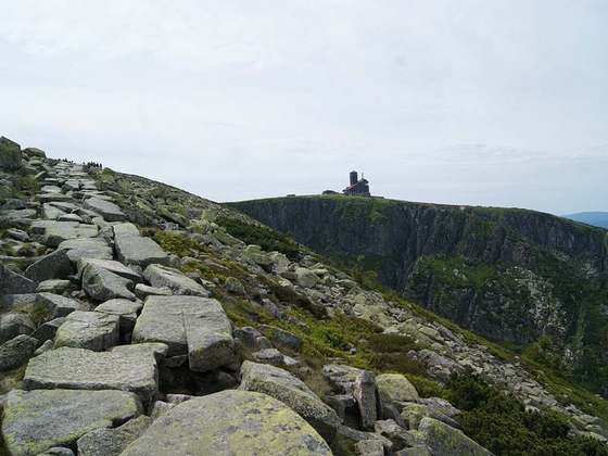
The Polish–Czech Friendship Trail is a public walking path in the Giant Mountains. The path runs on both sides of the Czech–Polish border, along the main ridge and crosses or traverses all its summits. The maintenance of the trail is performed by the staff of both adjacent national parks: the Polish Karkonosze National Park and the Czech Krkonoše National Park. The start point is located on Szrenica and the end in the Okraj pass / Pomezní boudy; the length of the trail is approx. 30 km; the level of difficulty is moderate. The trail partially overlaps with ski trails. The trail is marked with red stripe signs. Many places at the trail are equipped with two signposts parallelly: with Polish one in Polish language according to Polish standards, with distances in hours, and with Czech one in Czech language according to Czech standards, with distances in kilometers.
From the Wikipedia article “Polish–Czech Friendship Trail”, CC BY-SA 4.0.
Trail facts
- Countries
- Poland, Czech Republic
- Continent
- Europe
- Trail point
- 50.73720, 15.73190 (Wikidata coordinate)
- Wikidata
- Q3502406
Hiked it?
Log this hikeAdd a GPX file for the Verified Track badge. The first and last 500 m are trimmed off before anything is measured, and the file itself is not kept.
Photo: “Sněžka, pohled na cestu česko-polského přátelství.jpg” by Honza Groh (Jagro), CC BY-SA 3.0, via Wikimedia Commons (resized).