7-day forecast
Open-Meteo · trail point · local dates · last updated Nov 11, 2026, 3:10 PM PTThu 12
Rain showers
16°C / 10°C
100% · 5.2 mm
Wind 29 km/h
PoorFri 13
Overcast
16°C / 8°C
0% · 0.0 mm
Wind 21 km/h
GoodSat 14
Rain showers
15°C / 7°C
39% · 0.8 mm
Wind 21 km/h
FairSun 15
Fog
14°C / 8°C
31% · 0.3 mm
Wind 19 km/h
FairMon 16
Overcast
15°C / 6°C
10% · 0.0 mm
Wind 18 km/h
GoodTue 17
Overcast
15°C / 12°C
13% · 0.3 mm
Wind 15 km/h
GoodWed 18
Overcast
14°C / 9°C
15% · 0.0 mm
Wind 31 km/h
GoodRoute
No route line in this build. No OpenStreetMap route relation is linked for this trail.
About this trail
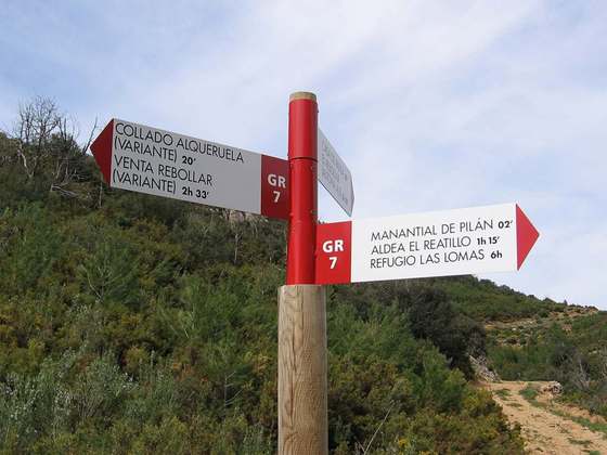
El Camino del Cid is a cultural and tourist route that crosses Spain from Castile and León in the northwest to Alicante and the Mediterranean coast in the southeast. It follows the history and the legend of Rodrigo Díaz de Vivar, known as El Cid, a medieval knight of the 11th century who is one of Spain’s most important folk heroes. El Cid is also a well-known literary character as the protagonist of El Cantar de mio Cid, a Spanish medieval epic poem written at the end of the 12th century or beginning of the 13th. The main travel guide for the route is the Cantar itself, which tells of the adventures of El Cid following his exile, fighting to survive against both Moors and Christians.
From the Wikipedia article “Camino del Cid”, CC BY-SA 4.0.
Trail facts
- Length
- 1,025 km · 637 mi (Wikidata)
- Countries
- Spain
- Continent
- Europe
- Trail point
- 40.34455, -1.10826 (Wikidata coordinate)
- Wikidata
- Q1227140
- Official info
- caminodelcid.org
Hiked it?
Log this hikeAdd a GPX file for the Verified Track badge. The first and last 500 m are trimmed off before anything is measured, and the file itself is not kept.