7-day forecast
Open-Meteo · trail point · local dates · last updated Nov 11, 2026, 3:10 PM PTThu 12
Light drizzle
10°C / 2°C
49% · 0.7 mm
Wind 12 km/h
FairFri 13
Heavy drizzle
8°C / 1°C
10% · 1.6 mm
Wind 10 km/h
FairSat 14
Fog
7°C / -0°C
1% · 0.0 mm
Wind 20 km/h
GoodSun 15
Rain showers
12°C / 2°C
84% · 6.0 mm
Wind 27 km/h
PoorMon 16
Drizzle
10°C / 6°C
84% · 6.4 mm
Wind 25 km/h
PoorTue 17
Drizzle
8°C / 4°C
77% · 7.1 mm
Wind 26 km/h
PoorWed 18
Drizzle
9°C / 4°C
78% · 7.2 mm
Wind 25 km/h
PoorRoute
Route line © OpenStreetMap contributors (ODbL), simplified. Dot: trail point.
About this trail
The GR 57 or Vallée de l'Ourthe et Sentier du nord is a GR footpath between Belgium and Luxembourg. About 265 km long, it goes through four regions:The city and surroundings of Liège The valley of the Ourthe The Sûre and the basin of the Rhine The Oesling and Gutland
From the Wikipedia article “GR 57”, CC BY-SA 4.0.
Trail facts
- Length
- 279 km · 173 mi (Wikidata)
- Countries
- Belgium
- Continent
- Europe
- Trail point
- 50.14394, 5.66855 (OpenStreetMap route (first mapped point))
- OSM network
- National walking network
- Operator (OSM)
- SGR asbl
- Wikidata
- Q3478737
- OpenStreetMap
- relation 157527
- Official info
- grsentiers.org/topo-guides/27-gr-57-vallee-de-l-
Hiked it?
Log this hikeAdd a GPX file for the Verified Track badge. The first and last 500 m are trimmed off before anything is measured, and the file itself is not kept.
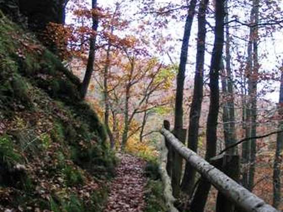
Photo: “Footpath GR 57 near 'Les Roches Noires'.jpg” by Pierre-Jacques DESPA, CC BY-SA 4.0, via Wikimedia Commons (resized).