Trails › North America › Canada
International Appalachian Trail
7-day forecast
Open-Meteo · trail point · local dates · last updated Nov 11, 2026, 3:10 PM PTWed 11
Snow
-5°C / -7°C
15% · 0.3 mm
Wind 19 km/h
FairThu 12
Fog
-4°C / -7°C
2% · 0.0 mm
Wind 20 km/h
GoodFri 13
Light snow
-1°C / -7°C
6% · 0.4 mm
Wind 13 km/h
FairSat 14
Light snow
-1°C / -6°C
53% · 3.3 mm
Wind 10 km/h
FairSun 15
Snow
-2°C / -10°C
62% · 2.6 mm
Wind 14 km/h
FairMon 16
Overcast
-2°C / -10°C
13% · 0.0 mm
Wind 10 km/h
GoodTue 17
Overcast
-0°C / -10°C
2% · 0.0 mm
Wind 6 km/h
GoodRoute
No route line in this build. No OpenStreetMap route relation is linked for this trail.
About this trail
The International Appalachian Trail was originally a hiking trail which ran from Katahdin Woods and Waters National Monument, in Maine, through New Brunswick, to the Gaspé Peninsula of Quebec, after which it followed a ferry route to Newfoundland, and then continued to the northern-easternmost point of the Appalachian Mountains at Belle Isle, Newfoundland and Labrador. As of July 2025, there are widely geographically dispersed IAT-branded walking trails in Greenland, Iceland, Norway, Sweden, Denmark, Scotland, Northern Ireland, Ireland, Isle of Man, Wales, England, Spain, Portugal, and Morocco.
From the Wikipedia article “International Appalachian Trail”, CC BY-SA 4.0.
Trail facts
- Length
- 3,100 km · 1,926 mi (Wikidata)
- Countries
- Canada, United States
- Continent
- North America
- Trail point
- 48.96000, -66.33972 (Wikidata coordinate)
- Wikidata
- Q656486
- Official info
- iat-sia.org
Hiked it?
Log this hikeAdd a GPX file for the Verified Track badge. The first and last 500 m are trimmed off before anything is measured, and the file itself is not kept.
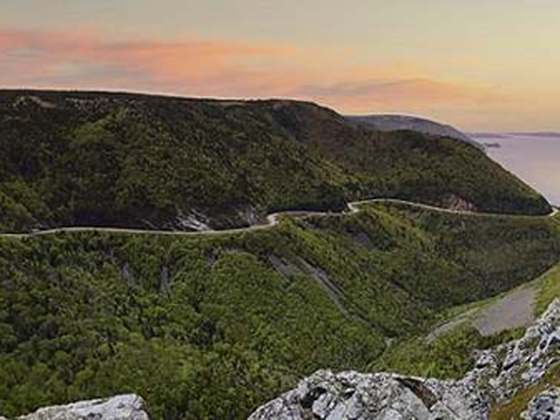
Photo: “International Appalachian Trail Cap Gaspé.jpg” by TCY, CC BY-SA 2.5, via Wikimedia Commons (resized).