7-day forecast
Open-Meteo · trail point · local dates · last updated Nov 11, 2026, 3:10 PM PTThu 12
Clear sky
22°C / 12°C
0% · 0.0 mm
Wind 16 km/h
GoodFri 13
Overcast
26°C / 14°C
0% · 0.0 mm
Wind 10 km/h
GoodSat 14
Overcast
27°C / 16°C
0% · 0.0 mm
Wind 13 km/h
GoodSun 15
Partly cloudy
24°C / 15°C
0% · 0.0 mm
Wind 15 km/h
GoodMon 16
Partly cloudy
23°C / 14°C
0% · 0.0 mm
Wind 15 km/h
GoodTue 17
Fog
22°C / 13°C
0% · 0.0 mm
Wind 12 km/h
GoodWed 18
Overcast
21°C / 13°C
3% · 0.0 mm
Wind 14 km/h
GoodRoute
No route line in this build. This is a very long route, so only its start point is used.
About this trail
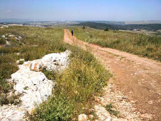
The Israel National Trail is a hiking trail that crosses the entire length of Israel, with its northern end at mount Hermon in the far north of the country, extending to Eilat at the southernmost tip of Israel on the Red Sea, with a total length of 1,040 km (650 mi). The trail was inaugurated in 1995.
From the Wikipedia article “Israel National Trail”, CC BY-SA 4.0.
Trail facts
- Length
- 1,088 km · 676 mi (Wikidata)
- Countries
- Israel
- Continent
- Asia
- Trail point
- 31.39775, 34.86151 (Wikidata coordinate)
- Wikidata
- Q583897
- OpenStreetMap
- relation 282071
- Official info
- teva.org.il/israel-national-trail
Hiked it?
Log this hikeAdd a GPX file for the Verified Track badge. The first and last 500 m are trimmed off before anything is measured, and the file itself is not kept.
Photo: “Israel National Trail east Wadi Dishon.jpg” by Diana Barshaw (talk · contribs), Public domain, via Wikimedia Commons (resized).