7-day forecast
Open-Meteo · trail point · local dates · last updated Nov 11, 2026, 3:10 PM PTThu 12
Light rain
12°C / 10°C
100% · 13.0 mm
Wind 4 km/h
PoorFri 13
Light rain
16°C / 8°C
50% · 0.5 mm
Wind 14 km/h
FairSat 14
Overcast
11°C / 7°C
0% · 0.0 mm
Wind 6 km/h
GoodSun 15
Light rain
9°C / 6°C
38% · 0.7 mm
Wind 5 km/h
FairMon 16
Light rain
9°C / 8°C
52% · 2.3 mm
Wind 6 km/h
FairTue 17
Light rain
13°C / 8°C
54% · 6.1 mm
Wind 8 km/h
FairWed 18
Rain
15°C / 10°C
55% · 23.9 mm
Wind 7 km/h
FairRoute
No route line in this build. This is a very long route, so only its start point is used.
About this trail
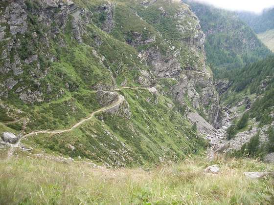
La Via dei Monti Lariani is a long-distance footpath in the hills on the west side of Lake Como, in Lombardy, Italy. Its total length is approximately 125 km, and its average altitude is about 1000 m, compared with the approximately 200 m of the lake shore. The trail starts in Cernobbio, just north-west of the city of Como, and ends at Sorico, at the northern extreme of the lake. The trail is conventionally divided into four numbered sections, each with different waymarking, but these do not correspond to days of walking; Sections 1-3 would each involve at least two days' walking for a normally fit person, while the fourth section is itself divided into two sections each of which could well require more than a single day. The path runs through a mixture of forest and pasture land, frequently offering magnificent views over the lake.
From the Wikipedia article “La Via dei Monti Lariani”, CC BY-SA 4.0.
Trail facts
- Length
- 125 km · 78 mi (Wikidata)
- Countries
- Italy
- Continent
- Europe
- Trail point
- 46.17377, 9.38373 (Wikidata coordinate)
- OSM network
- Regional walking network
- Operator (OSM)
- Comunità montane "Lario Intelvese" e "Alpi Lepontine", Club Alpino Italiano sezioni di Como, Moltrasio, Menaggio, Dongo, Gravedona;Azienda di promozione turistica di Como;Camera di commercio di Como
- Wikidata
- Q4010800
- OpenStreetMap
- relation 1964235
Hiked it?
Log this hikeAdd a GPX file for the Verified Track badge. The first and last 500 m are trimmed off before anything is measured, and the file itself is not kept.
Photo: “Attraversamento III tra Pioda e Alpe Gada, vista all'indietro.jpg” by Kaitu, CC BY-SA 4.0, via Wikimedia Commons (resized).