7-day forecast
Open-Meteo · trail point · local dates · last updated Nov 11, 2026, 3:10 PM PTThu 12
Light rain
1°C / -1°C
100% · 6.4 mm
Wind 33 km/h
PoorFri 13
Heavy snow
1°C / -10°C
100% · 26.2 mm
Wind 29 km/h
PoorSat 14
Light snow
-6°C / -11°C
0% · 0.4 mm
Wind 22 km/h
FairSun 15
Fog
-2°C / -10°C
3% · 0.0 mm
Wind 21 km/h
GoodMon 16
Light rain
-0°C / -4°C
80% · 8.3 mm
Wind 29 km/h
PoorTue 17
Snow showers
-0°C / -8°C
81% · 9.7 mm
Wind 26 km/h
PoorWed 18
Snow showers
-2°C / -8°C
61% · 1.8 mm
Wind 26 km/h
FairRoute
No route line in this build. No OpenStreetMap route relation is linked for this trail.
About this trail
Orla Perć, in English known as the Eagle's Path, is a tourist trail in the Tatra Mountains, in southern Poland. It is considered one of the most difficult and dangerous public paths in the entire Tatras and is therefore a suitable route only for experienced climbers. The path is marked with red signs. Since it was established in the early 20th century, at least 112 people have lost their lives on the route. The number of fatalities is estimated to have increased to around 140.
From the Wikipedia article “Orla Perć”, CC BY-SA 4.0.
Trail facts
- Length
- 4.5 km · 2.8 mi (Wikidata)
- Countries
- Poland
- Continent
- Europe
- Trail point
- 49.21833, 20.02861 (Wikidata coordinate)
- Wikidata
- Q783074
Hiked it?
Log this hikeAdd a GPX file for the Verified Track badge. The first and last 500 m are trimmed off before anything is measured, and the file itself is not kept.
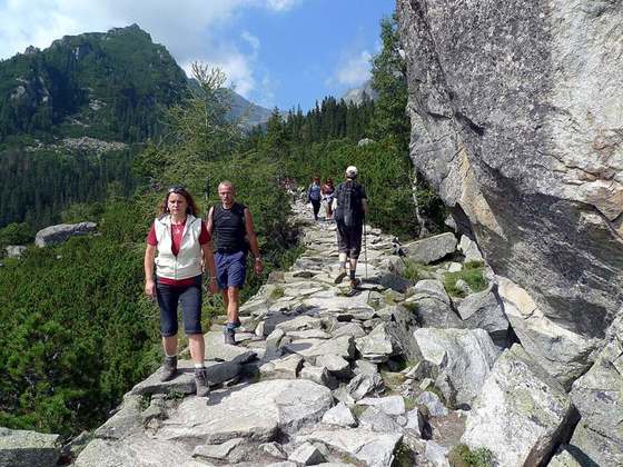
Photo: “Zejscie-z-koziego-wierchu.jpg” by Hochlik, CC BY 2.5, via Wikimedia Commons (resized).