Trails › North America › United States
Pacific Northwest Trail
7-day forecast
Open-Meteo · trail point · local dates · last updated Nov 11, 2026, 3:10 PM PTWed 11
Fog
8°C / 3°C
2% · 0.0 mm
Wind 22 km/h
GoodThu 12
Overcast
8°C / 3°C
0% · 0.0 mm
Wind 22 km/h
GoodFri 13
Overcast
9°C / 1°C
39% · 0.0 mm
Wind 14 km/h
FairSat 14
Light drizzle
3°C / -1°C
39% · 0.6 mm
Wind 9 km/h
FairSun 15
Heavy snow
-1°C / -2°C
71% · 12.9 mm
Wind 9 km/h
PoorMon 16
Drizzle
0°C / -6°C
71% · 2.1 mm
Wind 6 km/h
PoorTue 17
Overcast
0°C / -7°C
13% · 0.0 mm
Wind 3 km/h
GoodRoute
No route line in this build. This is a very long route, so only its start point is used.
About this trail
The Pacific Northwest Trail (PNT) is a 1,200-mile (1,900 km) hiking trail running from the Continental Divide in Montana to the Pacific Ocean on Washington's Olympic Coast. Along the way, the PNT crosses three national parks, seven national forests, and two other national scenic trails. It travels against the grain of several mountain ranges, including the Continental Divide, Whitefish Divide, Purcells, Selkirks, Kettles, Cascades, and Olympics. It was designated as the Pacific Northwest National Scenic Trail by Congress in 2009.
From the Wikipedia article “Pacific Northwest Trail”, CC BY-SA 4.0.
Trail facts
- Length
- 1,931 km · 1,200 mi (Wikidata)
- Countries
- United States
- Continent
- North America
- Trail point
- 48.55610, -118.49640 (OpenStreetMap route (first mapped point))
- OSM network
- National walking network
- Operator (OSM)
- Pacific Northwest Trail Association
- Wikidata
- Q3360192
- OpenStreetMap
- relation 11225405
- Official info
- pnt.org
Hiked it?
Log this hikeAdd a GPX file for the Verified Track badge. The first and last 500 m are trimmed off before anything is measured, and the file itself is not kept.
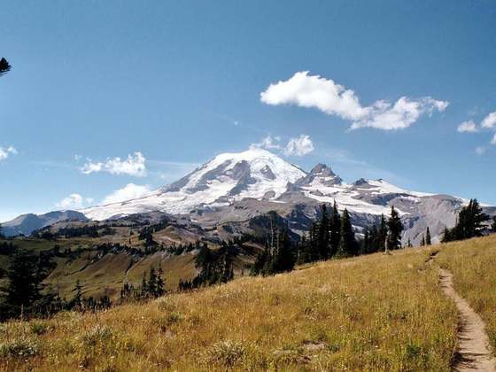
Photo: “On the Pacific Northwest Trail.jpg” by Pierre Nordique from Seattle, CC BY 2.0, via Wikimedia Commons (resized).