Trails › North America › United States
Wonderland Trail
7-day forecast
Open-Meteo · trail point · local dates · last updated Nov 11, 2026, 3:10 PM PTWed 11
Fog
8°C / 4°C
2% · 0.0 mm
Wind 30 km/h
GoodThu 12
Overcast
7°C / 2°C
3% · 0.0 mm
Wind 38 km/h
GoodFri 13
Snow
6°C / -1°C
83% · 7.2 mm
Wind 30 km/h
PoorSat 14
Snow
2°C / -1°C
77% · 8.4 mm
Wind 11 km/h
PoorSun 15
Snow showers
1°C / -1°C
96% · 21.2 mm
Wind 11 km/h
PoorMon 16
Snow showers
1°C / -6°C
50% · 3.2 mm
Wind 9 km/h
FairTue 17
Overcast
2°C / -7°C
23% · 0.0 mm
Wind 9 km/h
GoodRoute
Route line © OpenStreetMap contributors (ODbL), simplified. Dot: trail point.
About this trail
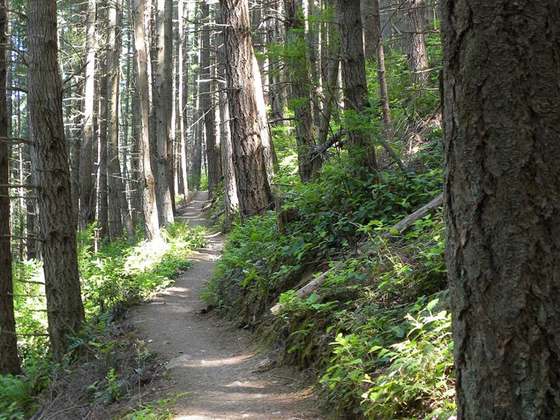
The Wonderland Trail is an approximately 93-mile (150 km) hiking trail that circumnavigates Mount Rainier in Mount Rainier National Park, Washington, United States. The trail goes over many ridges of Mount Rainier for a cumulative 22,000 feet (6,700 m) of elevation gain. The trail was built in 1915. In 1981, it was designated a National Recreation Trail. An estimated 200 to 250 people a year complete the entire trail with several thousand others doing shorter sections of it. The average time taken to complete the entire trip is 10 to 14 days.
From the Wikipedia article “Wonderland Trail”, CC BY-SA 4.0.
Trail facts
- Length
- 145 km · 90 mi (Wikidata)
- Countries
- United States
- Continent
- North America
- Trail point
- 46.86890, -121.65920 (Wikidata coordinate)
- OSM network
- Regional walking network
- Operator (OSM)
- Mount Rainier National Park
- Wikidata
- Q3498361
- OpenStreetMap
- relation 4111743
- Official info
- nps.gov/mora/planyourvisit/the-wonderland-trail.
Hiked it?
Log this hikeAdd a GPX file for the Verified Track badge. The first and last 500 m are trimmed off before anything is measured, and the file itself is not kept.
Photo: “CowlitzDivide.JPG” by Patrick Leahy (Patleahy). Original uploader was Patleahy at en.wikipedia, Public domain, via Wikimedia Commons (resized).