7-day forecast
Open-Meteo · trail point · local dates · last updated Nov 11, 2026, 3:10 PM PTThu 12
Rain
13°C / 10°C
100% · 44.5 mm
Wind 12 km/h
PoorFri 13
Rain showers
14°C / 9°C
88% · 20.8 mm
Wind 11 km/h
PoorSat 14
Fog
12°C / 2°C
6% · 0.0 mm
Wind 8 km/h
GoodSun 15
Light rain
8°C / 2°C
63% · 8.1 mm
Wind 6 km/h
FairMon 16
Overcast
11°C / 6°C
51% · 0.0 mm
Wind 6 km/h
FairTue 17
Fog
18°C / 4°C
25% · 0.0 mm
Wind 14 km/h
GoodWed 18
Overcast
20°C / 14°C
33% · 0.0 mm
Wind 35 km/h
FairRoute
No route line in this build. This is a very long route, so only its start point is used.
About this trail
Hiking trail in Italy.
Description from Wikidata (CC0).
Trail facts
- Length
- 130 km · 81 mi (Wikidata)
- Countries
- Italy
- Continent
- Europe
- Trail point
- 44.39528, 11.25444 (Wikidata coordinate)
- OSM network
- Regional walking network
- Operator (OSM)
- Club Alpino Italiano
- Wikidata
- Q4010784
- OpenStreetMap
- relation 222322
- Official info
- viadeglidei.it
Hiked it?
Log this hikeAdd a GPX file for the Verified Track badge. The first and last 500 m are trimmed off before anything is measured, and the file itself is not kept.
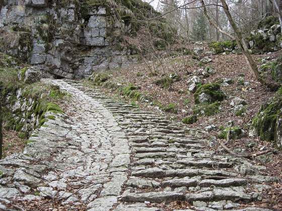
Photo: “Via degli Dei, Casalecchio di Reno, Sentiero dei Bregoli 04.jpg” by Mongolo1984, CC BY-SA 4.0, via Wikimedia Commons (resized).