● LIVE
7-day forecast
Open-Meteo · trail point · local dates · last updated Nov 11, 2026, 3:10 PM PTThu 12
Light rain
4°C / 2°C
100% · 7.7 mm
Wind 4 km/h
PoorFri 13
Light rain
3°C / -4°C
90% · 7.5 mm
Wind 10 km/h
PoorSat 14
Clear sky
2°C / -4°C
0% · 0.0 mm
Wind 5 km/h
GoodSun 15
Light snow
2°C / -4°C
17% · 0.2 mm
Wind 6 km/h
FairMon 16
Snow
2°C / -2°C
29% · 6.8 mm
Wind 8 km/h
FairTue 17
Light snow
3°C / -3°C
44% · 1.2 mm
Wind 8 km/h
FairWed 18
Light snow
3°C / 0°C
75% · 19.5 mm
Wind 9 km/h
PoorRoute
Route line © OpenStreetMap contributors (ODbL), simplified. Dot: trail point.
About this trail
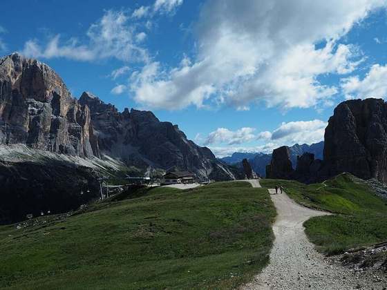
Alta Via 3 is a high route located in the Italian Dolomites between Niederdorf in the north and Longarone in the south.
From the Wikipedia article “Alta Via 3”, CC BY-SA 4.0.
Trail facts
- Countries
- Italy
- Continent
- Europe
- Trail point
- 46.70857, 12.18407 (Wikidata coordinate)
- OSM network
- Regional walking network
- Wikidata
- Q1236279
- OpenStreetMap
- relation 1657836
Hiked it?
Log this hikeAdd a GPX file for the Verified Track badge. The first and last 500 m are trimmed off before anything is measured, and the file itself is not kept.
More cams near this trail
● LIVE
● LIVE
● LIVE