Trails › North America › Canada
Chilkoot Trail
7-day forecast
Open-Meteo · trail point · local dates · last updated Nov 11, 2026, 3:10 PM PTWed 11
Snow showers
0°C / -2°C
100% · 11.6 mm
Wind 17 km/h
PoorThu 12
Snow showers
-2°C / -9°C
82% · 1.0 mm
Wind 10 km/h
PoorFri 13
Snow
-4°C / -9°C
76% · 2.2 mm
Wind 9 km/h
PoorSat 14
Snow showers
-2°C / -4°C
88% · 4.1 mm
Wind 8 km/h
PoorSun 15
Snow showers
-2°C / -4°C
65% · 6.9 mm
Wind 8 km/h
FairMon 16
Snow showers
-1°C / -4°C
78% · 9.0 mm
Wind 14 km/h
PoorTue 17
Snow
-2°C / -2°C
77% · 13.2 mm
Wind 11 km/h
PoorRoute
Route line © OpenStreetMap contributors (ODbL), simplified. Dot: trail point.
About this trail
The Chilkoot Trail is a 33-mile (53 km) trail through the Coast Mountains that leads from Dyea, Alaska, in the United States to Bennett, British Columbia, in Canada. It was a major access route from the coast to Yukon goldfields in the late 1890s. The trail became obsolete in 1899 when a railway was built from Dyea's neighbor port Skagway along the parallel White Pass trail.
From the Wikipedia article “Chilkoot Trail”, CC BY-SA 4.0.
Trail facts
- Length
- 53 km · 33 mi (Wikidata)
- Countries
- Canada, United States
- Continent
- North America
- Trail point
- 59.69844, -135.23512 (Wikidata coordinate)
- OSM network
- International walking network
- Operator (OSM)
- US National Park Service, Parks Canada
- Wikidata
- Q3389258
- OpenStreetMap
- relation 1225005
- Official info
- nps.gov/klgo/planyourvisit/chilkoottrail.htm
Hiked it?
Log this hikeAdd a GPX file for the Verified Track badge. The first and last 500 m are trimmed off before anything is measured, and the file itself is not kept.
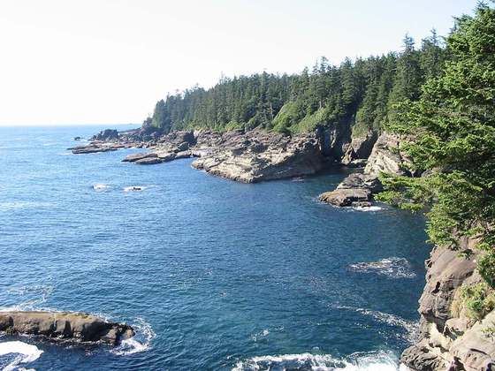
Photo: “ChilkootTrailMeltOff.jpg” by Jonathan.s.kt at English Wikipedia, CC BY-SA 3.0, via Wikimedia Commons (resized).