Trails › North America › Canada
West Coast Trail
7-day forecast
Open-Meteo · trail point · local dates · last updated Nov 11, 2026, 3:10 PM PTWed 11
Heavy rain
15°C / 11°C
100% · 58.2 mm
Wind 39 km/h
PoorThu 12
Light rain
13°C / 9°C
95% · 9.8 mm
Wind 30 km/h
PoorFri 13
Rain showers
13°C / 10°C
90% · 26.5 mm
Wind 41 km/h
PoorSat 14
Rain
10°C / 9°C
98% · 38.0 mm
Wind 32 km/h
PoorSun 15
Rain showers
11°C / 8°C
100% · 44.0 mm
Wind 30 km/h
PoorMon 16
Rain showers
9°C / 8°C
94% · 17.3 mm
Wind 18 km/h
PoorTue 17
Light drizzle
11°C / 6°C
49% · 0.3 mm
Wind 8 km/h
FairRoute
Route line © OpenStreetMap contributors (ODbL), simplified. Dot: trail point.
About this trail
The West Coast Trail, originally called the Dominion Lifesaving Trail, is a 75 km (47 mi) backpacking trail following the southwestern edge of Vancouver Island in British Columbia, Canada. It was built in 1907 to facilitate the rescue of shipwrecked survivors along the coast, part of the treacherous Graveyard of the Pacific. It is now part of the Pacific Rim National Park and is often rated by hiking guides as one of the world's top hiking trails.
From the Wikipedia article “West Coast Trail”, CC BY-SA 4.0.
Trail facts
- Length
- 75 km · 47 mi (Wikidata)
- Countries
- Canada
- Continent
- North America
- Trail point
- 48.66448, -124.83762 (Wikidata coordinate)
- OSM network
- Regional walking network
- Wikidata
- Q3434548
- OpenStreetMap
- relation 6955341
- Official info
- pc.gc.ca/eng/pn-np/bc/pacificrim/activ/activ6a.a
Hiked it?
Log this hikeAdd a GPX file for the Verified Track badge. The first and last 500 m are trimmed off before anything is measured, and the file itself is not kept.
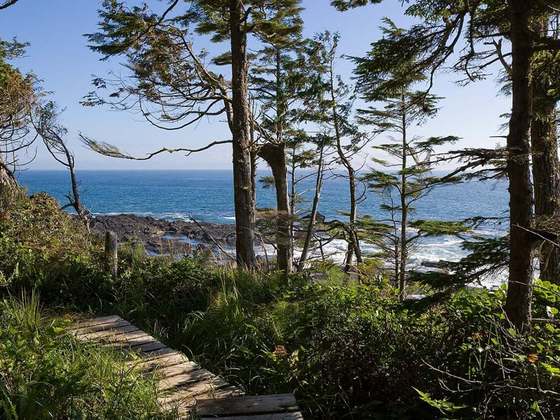
Photo: “WestCoastTrailCost2.jpg” by User:Jonathan.s.kt, CC BY-SA 3.0, via Wikimedia Commons (resized).