7-day forecast
Open-Meteo · trail point · local dates · last updated Nov 11, 2026, 3:10 PM PTWed 11
Light rain
6°C / 2°C
98% · 2.0 mm
Wind 24 km/h
PoorThu 12
Light snow
7°C / 2°C
99% · 4.3 mm
Wind 32 km/h
PoorFri 13
Light drizzle
7°C / 2°C
34% · 0.1 mm
Wind 23 km/h
FairSat 14
Light drizzle
7°C / 4°C
18% · 0.8 mm
Wind 27 km/h
FairSun 15
Light rain
6°C / 4°C
72% · 29.8 mm
Wind 42 km/h
PoorMon 16
Light rain
4°C / 3°C
67% · 13.5 mm
Wind 37 km/h
FairTue 17
Light drizzle
4°C / -0°C
42% · 0.6 mm
Wind 26 km/h
FairRoute
Route line © OpenStreetMap contributors (ODbL), simplified. Dot: trail point.
About this trail
The Formartine and Buchan Way is a long-distance trail in Scotland, extending from Dyce north to Peterhead and Fraserburgh in the Buchan and Formartine districts of Aberdeenshire in Scotland. It follows the track of a former railway line, the Formartine and Buchan Railway, and is open to walkers, cyclists and horse riders. The railway closed in 1979 (Fraserburgh) and 1970 (Maud-Peterhead). The walkway opened in the early 1990s, and is managed by Aberdeenshire Council. It is listed as one of Scotland's Great Trails by NatureScot. Highlights along the route include Aden Country Park, Deer Abbey at Old Deer, the White Horse at Mormond Hill, and several sites associated with the area’s railway heritage.
From the Wikipedia article “Formartine and Buchan Way”, CC BY-SA 4.0.
Trail facts
- Length
- 86 km · 53 mi (OpenStreetMap distance tag)
- Countries
- United Kingdom
- Continent
- Europe
- Trail point
- 57.44770, -2.11310 (Wikidata coordinate)
- OSM network
- National walking network
- Wikidata
- Q5470009
- OpenStreetMap
- relation 1756397
- Official info
- aberdeenshire.gov.uk/paths-and-outdoor-access/lo
Hiked it?
Log this hikeAdd a GPX file for the Verified Track badge. The first and last 500 m are trimmed off before anything is measured, and the file itself is not kept.
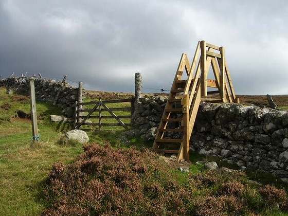
Photo: “Barrier on Formartine and Buchan cycle route at Auchnagatt.jpg” by Ellievking1, CC BY-SA 4.0, via Wikimedia Commons (resized).