Trails › South America › Peru
Inca Trail to Machu Picchu
7-day forecast
Open-Meteo · trail point · local dates · last updated Nov 11, 2026, 3:10 PM PTWed 11
Heavy drizzle
24°C / 8°C
100% · 1.8 mm
Wind 15 km/h
PoorThu 12
Drizzle
24°C / 10°C
97% · 2.3 mm
Wind 13 km/h
PoorFri 13
Light drizzle
23°C / 10°C
100% · 1.9 mm
Wind 18 km/h
PoorSat 14
Heavy drizzle
22°C / 10°C
90% · 3.3 mm
Wind 14 km/h
PoorSun 15
Light drizzle
25°C / 9°C
86% · 1.2 mm
Wind 12 km/h
PoorMon 16
Fog
28°C / 7°C
21% · 0.0 mm
Wind 11 km/h
GoodTue 17
Fog
29°C / 9°C
4% · 0.0 mm
Wind 6 km/h
GoodRoute
Route line © OpenStreetMap contributors (ODbL), simplified. Dot: trail point.
About this trail
The Inca Trail to Machu Picchu is a hiking trail in Peru that terminates at Machu Picchu. It consists of three overlapping trails: Mollepata, Classic, and One Day. Mollepata is the longest of the three routes with the highest mountain pass and intersects with the Classic route before crossing Warmiwañusqa. Located in the Andes mountain range, the trail passes through several types of Andean environments including cloud forest and alpine tundra. Settlements, tunnels, and many Incan ruins are located along the trail before ending the terminus at the Sun Gate on Machu Picchu mountain. The two longer routes require an ascent to beyond 4,200 metres (13,800 ft) above sea level, which can result in altitude sickness.
From the Wikipedia article “Inca Trail to Machu Picchu”, CC BY-SA 4.0.
Trail facts
- Length
- 38 km · 24 mi (OpenStreetMap distance tag)
- Countries
- Peru
- Continent
- South America
- Trail point
- -13.25810, -72.26330 (Wikidata coordinate)
- OSM network
- Regional walking network
- Operator (OSM)
- Ministerio de Cultura
- Wikidata
- Q6014019
- OpenStreetMap
- relation 15703494
Hiked it?
Log this hikeAdd a GPX file for the Verified Track badge. The first and last 500 m are trimmed off before anything is measured, and the file itself is not kept.
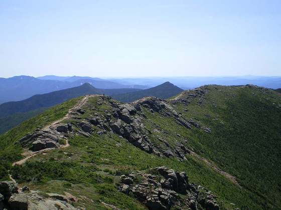
Photo: “Inca Trail Phuyupatamarka.jpg” by Steve Pastor at English Wikipedia, CC BY 3.0, via Wikimedia Commons (resized).