Trails › North America › Canada
Juan de Fuca Marine Trail
7-day forecast
Open-Meteo · trail point · local dates · last updated Nov 11, 2026, 3:10 PM PTWed 11
Light rain
16°C / 12°C
87% · 13.0 mm
Wind 25 km/h
PoorThu 12
Rain
14°C / 9°C
74% · 10.8 mm
Wind 26 km/h
PoorFri 13
Light rain
14°C / 10°C
75% · 6.3 mm
Wind 39 km/h
PoorSat 14
Rain
11°C / 9°C
91% · 29.3 mm
Wind 16 km/h
PoorSun 15
Rain showers
10°C / 7°C
100% · 35.5 mm
Wind 22 km/h
PoorMon 16
Heavy drizzle
9°C / 6°C
74% · 5.4 mm
Wind 14 km/h
PoorTue 17
Overcast
10°C / 5°C
34% · 0.0 mm
Wind 9 km/h
FairRoute
No route line in this build. No OpenStreetMap route relation is linked for this trail.
About this trail
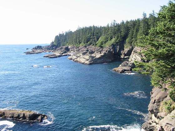
The Juan de Fuca Marine Trail is a rugged 47 kilometres (29 mi) wilderness hiking trail located within Juan de Fuca Provincial Park along the southwestern coast of Vancouver Island, British Columbia, Canada. The trail stretches from China Beach, 35 kilometres (22 mi) west of Sooke, to Botanical Beach, just outside Port Renfrew.
From the Wikipedia article “Juan de Fuca Marine Trail”, CC BY-SA 4.0.
Trail facts
- Countries
- Canada
- Continent
- North America
- Trail point
- 48.46834, -124.23914 (Wikidata coordinate)
- Wikidata
- Q6301269
- Official info
- env.gov.bc.ca/bcparks/explore/parkpgs/juan_de_fu
Hiked it?
Log this hikeAdd a GPX file for the Verified Track badge. The first and last 500 m are trimmed off before anything is measured, and the file itself is not kept.
Photo: “Juan de Fuca trail Wald.jpg” by Ikiwaner, CC BY-SA 3.0, via Wikimedia Commons (resized).