7-day forecast
Open-Meteo · trail point · local dates · last updated Nov 11, 2026, 3:10 PM PTThu 12
Light drizzle
26°C / 20°C
0% · 1.2 mm
Wind 19 km/h
FairFri 13
Heavy drizzle
25°C / 22°C
100% · 2.9 mm
Wind 24 km/h
PoorSat 14
Thunderstorm
28°C / 22°C
100% · 53.9 mm
Wind 26 km/h
PoorSun 15
Light drizzle
25°C / 21°C
54% · 1.9 mm
Wind 11 km/h
FairMon 16
Rain showers
25°C / 23°C
78% · 34.8 mm
Wind 23 km/h
PoorTue 17
Drizzle
27°C / 23°C
77% · 4.8 mm
Wind 20 km/h
PoorWed 18
Light drizzle
24°C / 18°C
66% · 1.8 mm
Wind 28 km/h
FairRoute
Route line © OpenStreetMap contributors (ODbL), simplified. Dot: trail point.
About this trail
The MacLehose Trail is a 100-kilometre (62 mi) hiking trail that crosses much of the New Territories, Hong Kong, starting from Pak Tam Chung, Sai Kung District in the east to Tuen Mun Town, Tuen Mun District in the west. It is the longest trail in Hong Kong and the path is marked by distance posts at 500-metre intervals. The trail is named after Murray MacLehose, Baron MacLehose of Beoch, the longest-serving governor of Hong Kong, who established the Country Parks and was himself an enthusiastic hiker. The trail passes through a variety of natural scenery including beaches and mountains.
From the Wikipedia article “MacLehose Trail”, CC BY-SA 4.0.
Trail facts
- Length
- 100 km · 62 mi (Wikidata)
- Countries
- China
- Continent
- Asia
- Trail point
- 22.40001, 114.32381 (OpenStreetMap route (first mapped point))
- OSM network
- National walking network
- Operator (OSM)
- 漁農自然護理署 Agriculture, Fisheries and Conservation Department
- Wikidata
- Q8421867
- OpenStreetMap
- relation 1281208
Hiked it?
Log this hikeAdd a GPX file for the Verified Track badge. The first and last 500 m are trimmed off before anything is measured, and the file itself is not kept.
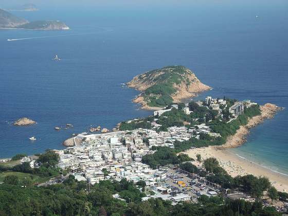
Photo: “End point of 2011 HK Trailwalker.JPG” by 圍棋一級, CC BY-SA 3.0, via Wikimedia Commons (resized).