Trails › North America › United States
Metacomet Trail
7-day forecast
Open-Meteo · trail point · local dates · last updated Nov 11, 2026, 3:10 PM PTWed 11
Overcast
14°C / 5°C
6% · 0.0 mm
Wind 13 km/h
GoodThu 12
Light rain
8°C / 5°C
96% · 8.7 mm
Wind 20 km/h
PoorFri 13
Snow
6°C / 2°C
90% · 11.7 mm
Wind 24 km/h
PoorSat 14
Overcast
5°C / 1°C
26% · 0.0 mm
Wind 18 km/h
GoodSun 15
Overcast
7°C / 0°C
0% · 0.0 mm
Wind 16 km/h
GoodMon 16
Clear sky
9°C / 1°C
0% · 0.0 mm
Wind 11 km/h
GoodTue 17
Clear sky
9°C / 0°C
0% · 0.0 mm
Wind 8 km/h
GoodRoute
Route line © OpenStreetMap contributors (ODbL), simplified. Dot: trail point.
About this trail
The Metacomet Trail is a 62.7-mile (100.9 km) Blue-Blazed hiking trail that traverses the Metacomet Ridge of central Connecticut as part of the New England National Scenic Trail. Despite being easily accessible and close to large population centers, the trail is considered remarkably rugged and scenic. The route includes many areas of unique ecologic, historic, and geologic interest. Notable features include waterfalls, dramatic cliff faces, woodlands, swamps, lakes, river flood plain, farmland, significant historic sites, and the summits of Talcott Mountain and the Hanging Hills. The Metacomet Trail is maintained largely through the efforts of the Connecticut Forest and Park Association.
From the Wikipedia article “Metacomet Trail”, CC BY-SA 4.0.
Trail facts
- Length
- 82 km · 51 mi (Wikidata)
- Countries
- United States
- Continent
- North America
- Trail point
- 41.77610, -72.79890 (Wikidata coordinate)
- OSM network
- Regional walking network
- Operator (OSM)
- Connecticut Forest and Park Association
- Wikidata
- Q3307201
- OpenStreetMap
- relation 900072
Hiked it?
Log this hikeAdd a GPX file for the Verified Track badge. The first and last 500 m are trimmed off before anything is measured, and the file itself is not kept.
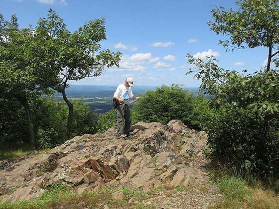
Photo: “Metacomet Trail near Rattlesnake Mountain, October 24, 2007.jpg” by Ragesoss, CC BY-SA 3.0, via Wikimedia Commons (resized).