7-day forecast
Open-Meteo · trail point · local dates · last updated Nov 11, 2026, 3:10 PM PTThu 12
Drizzle
16°C / 10°C
100% · 3.5 mm
Wind 20 km/h
PoorFri 13
Light drizzle
17°C / 8°C
0% · 0.2 mm
Wind 16 km/h
FairSat 14
Overcast
18°C / 7°C
2% · 0.0 mm
Wind 7 km/h
GoodSun 15
Overcast
18°C / 9°C
31% · 0.0 mm
Wind 14 km/h
FairMon 16
Drizzle
18°C / 8°C
45% · 1.1 mm
Wind 22 km/h
FairTue 17
Rain showers
16°C / 12°C
75% · 29.0 mm
Wind 16 km/h
PoorWed 18
Rain showers
15°C / 12°C
72% · 44.4 mm
Wind 9 km/h
PoorRoute
Route line © OpenStreetMap contributors (ODbL), simplified. Dot: trail point.
About this trail
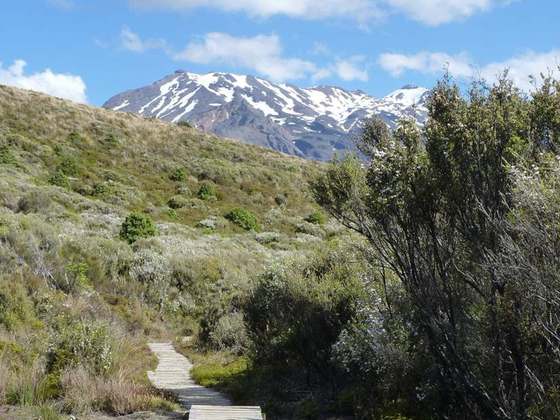
The Tongariro Alpine Crossing in Tongariro National Park is a tramping track in New Zealand, and is among the most popular day hikes in the country. The Tongariro National Park is a World Heritage site which has the distinction of dual status, as it has been acknowledged for both its natural and cultural significance.
From the Wikipedia article “Tongariro Alpine Crossing”, CC BY-SA 4.0.
Trail facts
- Length
- 19 km · 12 mi (OpenStreetMap distance tag)
- Countries
- New Zealand
- Continent
- Oceania
- Trail point
- -39.07394, 175.66380 (Wikidata coordinate)
- OSM network
- Regional walking network
- Operator (OSM)
- Department of Conservation
- Wikidata
- Q2441670
- OpenStreetMap
- relation 104369
- Official info
- doc.govt.nz/parks-and-recreation/places-to-go/ce
Hiked it?
Log this hikeAdd a GPX file for the Verified Track badge. The first and last 500 m are trimmed off before anything is measured, and the file itself is not kept.
Photo: “Tongariro Crossing Emerald Lakes Blue Lake.jpg” by User Yogi de on en.wikipedia, CC BY-SA 3.0, via Wikimedia Commons (resized).