7-day forecast
Open-Meteo · trail point · local dates · last updated Nov 11, 2026, 3:10 PM PTThu 12
Drizzle
11°C / 5°C
100% · 3.8 mm
Wind 19 km/h
PoorFri 13
Fog
14°C / 4°C
6% · 0.0 mm
Wind 10 km/h
GoodSat 14
Overcast
14°C / 4°C
11% · 0.0 mm
Wind 13 km/h
GoodSun 15
Overcast
13°C / 4°C
20% · 0.0 mm
Wind 17 km/h
GoodMon 16
Drizzle
13°C / 5°C
67% · 0.6 mm
Wind 27 km/h
FairTue 17
Rain showers
13°C / 8°C
78% · 38.5 mm
Wind 18 km/h
PoorWed 18
Rain showers
10°C / 8°C
76% · 72.4 mm
Wind 24 km/h
PoorRoute
Route line © OpenStreetMap contributors (ODbL), simplified. Dot: trail point.
About this trail
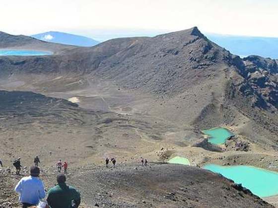
The Tongariro Northern Circuit, one of the New Zealand Great Walks, offers a three- to four-day tramp through Tongariro National Park New Zealand. Highlighted by the Tongariro Alpine Crossing, a full day of awe-inspiring landscapes, The entire trail spans a 50-kilometre (31 mi) around Mount Ngauruhoe. Approximately 2,500 hikers completed the walk in the 2021/22 season. This contrasts with the roughly 25,000 who solely walk the Tongariro Crossing segment.
From the Wikipedia article “Tongariro Northern Circuit”, CC BY-SA 4.0.
Trail facts
- Length
- 43 km · 27 mi (Wikidata)
- Countries
- New Zealand
- Continent
- Oceania
- Trail point
- -39.14567, 175.62471 (Wikidata coordinate)
- OSM network
- National walking network
- Operator (OSM)
- Department of Conservation
- Wikidata
- Q1258134
- OpenStreetMap
- relation 173345
- Official info
- doc.govt.nz/parks-and-recreation/places-to-go/ce
Hiked it?
Log this hikeAdd a GPX file for the Verified Track badge. The first and last 500 m are trimmed off before anything is measured, and the file itself is not kept.
Photo: “Tongariro Northern Circuit, New Zealand (4).JPG” by Michal Klajban, CC BY-SA 4.0, via Wikimedia Commons (resized).