7-day forecast
Open-Meteo · trail point · local dates · last updated Nov 11, 2026, 3:10 PM PTThu 12
Light drizzle
15°C / 10°C
88% · 1.7 mm
Wind 14 km/h
PoorFri 13
Light drizzle
13°C / 8°C
8% · 0.3 mm
Wind 14 km/h
FairSat 14
Light drizzle
16°C / 9°C
21% · 0.4 mm
Wind 14 km/h
FairSun 15
Rain
14°C / 11°C
100% · 28.3 mm
Wind 26 km/h
PoorMon 16
Rain showers
14°C / 5°C
82% · 10.1 mm
Wind 12 km/h
PoorTue 17
Heavy drizzle
10°C / 5°C
75% · 8.1 mm
Wind 15 km/h
PoorWed 18
Heavy drizzle
12°C / 6°C
83% · 10.2 mm
Wind 15 km/h
PoorRoute
Route line © OpenStreetMap contributors (ODbL), simplified. Dot: trail point.
About this trail
The Milford Track is a hiking route in New Zealand, located amidst mountains and temperate rain forest in Fiordland National Park in the southwest of the South Island. The 53.5 km (33.2 mi) hike starts at Glade Wharf at the head of Lake Te Anau and finishes in Milford Sound at Sandfly Point, traversing rainforests, wetlands, and an alpine pass.
From the Wikipedia article “Milford Track”, CC BY-SA 4.0.
Trail facts
- Countries
- New Zealand
- Continent
- Oceania
- Trail point
- -44.93206, 167.93020 (OpenStreetMap route (first mapped point))
- OSM network
- National walking network
- Operator (OSM)
- Department of Conservation
- Wikidata
- Q673819
- OpenStreetMap
- relation 1385121
- Official info
- doc.govt.nz/parks-and-recreation/places-to-go/fi
Hiked it?
Log this hikeAdd a GPX file for the Verified Track badge. The first and last 500 m are trimmed off before anything is measured, and the file itself is not kept.
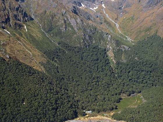
Photo: “MilfordTrack02.jpg” by Wuhte, CC BY-SA 3.0, via Wikimedia Commons (resized).