7-day forecast
Open-Meteo · trail point · local dates · last updated Nov 11, 2026, 3:10 PM PTThu 12
Drizzle
9°C / 3°C
90% · 2.9 mm
Wind 13 km/h
PoorFri 13
Fog
8°C / 1°C
0% · 0.0 mm
Wind 11 km/h
GoodSat 14
Light drizzle
12°C / 0°C
18% · 0.4 mm
Wind 13 km/h
FairSun 15
Rain
9°C / 4°C
100% · 29.5 mm
Wind 20 km/h
PoorMon 16
Rain showers
8°C / -2°C
89% · 10.7 mm
Wind 9 km/h
PoorTue 17
Drizzle
5°C / -2°C
72% · 3.0 mm
Wind 13 km/h
PoorWed 18
Rain showers
8°C / -0°C
83% · 11.4 mm
Wind 14 km/h
PoorRoute
Route line © OpenStreetMap contributors (ODbL), simplified. Dot: trail point.
About this trail
The Routeburn Track is a 32 km tramping (hiking) track found in the South Island of New Zealand. The track can be done in either direction, starting on the Queenstown side of the Southern Alps, at the northern end of Lake Wakatipu or on the Te Anau side, at the Divide, several kilometres from the Homer Tunnel to Milford Sound.
From the Wikipedia article “Routeburn Track”, CC BY-SA 4.0.
Trail facts
- Length
- 32 km · 20 mi (Wikidata)
- Countries
- New Zealand
- Continent
- Oceania
- Trail point
- -44.72695, 168.17034 (Wikidata coordinate)
- OSM network
- National walking network
- Operator (OSM)
- Depratment of Conservation
- Wikidata
- Q2170592
- OpenStreetMap
- relation 1385139
- Official info
- doc.govt.nz/parks-and-recreation/tracks-and-walk
Hiked it?
Log this hikeAdd a GPX file for the Verified Track badge. The first and last 500 m are trimmed off before anything is measured, and the file itself is not kept.
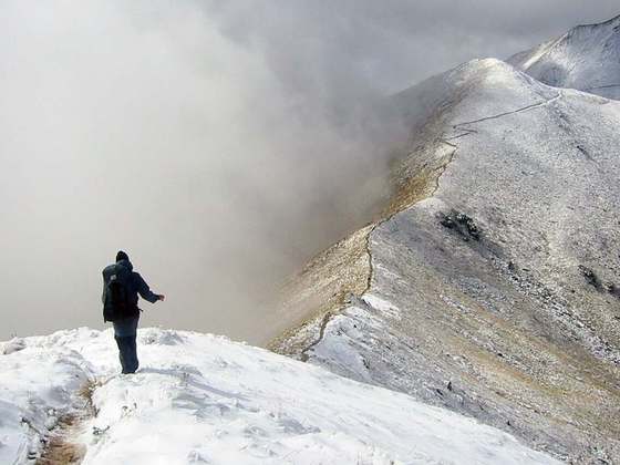
Photo: “MackenzieHut.jpg” by Steffen Sledz, CC BY-SA 3.0, via Wikimedia Commons (resized).