Trails › North America › United States
Murphy Trail and Bridge
7-day forecast
Open-Meteo · trail point · local dates · last updated Nov 11, 2026, 3:10 PM PTWed 11
Clear sky
13°C / 2°C
0% · 0.0 mm
Wind 12 km/h
GoodThu 12
Overcast
15°C / 4°C
0% · 0.0 mm
Wind 9 km/h
GoodFri 13
Overcast
12°C / 5°C
2% · 0.0 mm
Wind 10 km/h
GoodSat 14
Drizzle
10°C / 6°C
53% · 2.8 mm
Wind 16 km/h
FairSun 15
Overcast
9°C / 3°C
1% · 0.0 mm
Wind 5 km/h
GoodMon 16
Overcast
11°C / 5°C
4% · 0.0 mm
Wind 6 km/h
GoodTue 17
Mainly clear
12°C / 5°C
50% · 0.0 mm
Wind 6 km/h
FairRoute
No route line in this build. No OpenStreetMap route relation is linked for this trail.
About this trail
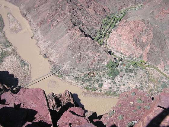
The Murphy Trail and Bridge in San Juan County, Utah, United States, were used to move livestock from winter range along the Green River to highland summer range from about 1917 to about 1964. The trail and bridge are located in what is now Canyonlands National Park and the trail is now used as a hiking path. The bridge was made from logs and rough-cut planking, and was built around 1917 by J. Idiart and D. Allies. The 10-foot-long (3.0 m) bridge was reconstructed in 1998 and no longer retains historic integrity.
From the Wikipedia article “Murphy Trail and Bridge”, CC BY-SA 4.0.
Trail facts
- Countries
- United States
- Continent
- North America
- Trail point
- 38.34361, -109.87083 (Wikidata coordinate)
- Wikidata
- Q6939029
Hiked it?
Log this hikeAdd a GPX file for the Verified Track badge. The first and last 500 m are trimmed off before anything is measured, and the file itself is not kept.