Trails › North America › United States
Katy Trail State Park
7-day forecast
Open-Meteo · trail point · local dates · last updated Nov 11, 2026, 3:10 PM PTWed 11
Fog
21°C / 5°C
9% · 0.0 mm
Wind 29 km/h
GoodThu 12
Overcast
10°C / 2°C
3% · 0.0 mm
Wind 30 km/h
GoodFri 13
Overcast
7°C / -0°C
0% · 0.0 mm
Wind 23 km/h
GoodSat 14
Overcast
9°C / -1°C
0% · 0.0 mm
Wind 10 km/h
GoodSun 15
Overcast
11°C / 0°C
5% · 0.0 mm
Wind 11 km/h
GoodMon 16
Partly cloudy
12°C / 1°C
8% · 0.0 mm
Wind 9 km/h
GoodTue 17
Partly cloudy
12°C / 1°C
0% · 0.0 mm
Wind 10 km/h
GoodRoute
Route line © OpenStreetMap contributors (ODbL), simplified. Dot: trail point.
About this trail
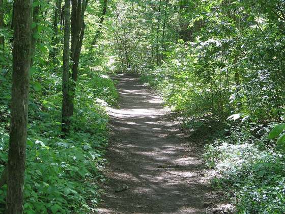
The Katy Trail State Park is a state park in the U.S. state of Missouri that contains the Katy Trail, the country's longest continuous recreational rail trail. It runs 240 miles (390 km), largely along the northern bank of the Missouri River, in the former right-of-way of the Missouri–Kansas–Texas Railroad. Open year-round from sunrise to sunset, it serves hikers, joggers, and cyclists. Its hard, flat surface is of "limestone pug".
From the Wikipedia article “Katy Trail State Park”, CC BY-SA 4.0.
Trail facts
- Length
- 382 km · 238 mi (Wikidata)
- Countries
- United States
- Continent
- North America
- Trail point
- 38.90350, -90.33140 (Wikidata coordinate)
- OSM network
- rcn
- Wikidata
- Q1736850
- OpenStreetMap
- relation 3193971
- Official info
- mostateparks.com/park/katy-trail-state-park
Hiked it?
Log this hikeAdd a GPX file for the Verified Track badge. The first and last 500 m are trimmed off before anything is measured, and the file itself is not kept.
Photo: “Katy Trail - Sunset (45259991641).jpg” by Heath Cajandig, CC BY 2.0, via Wikimedia Commons (resized).